This 2.4 million hectare landscape encompasses all land developed for dryland and irrigated agriculture and the region’s biodiversity, waterways, cultural heritage and community assets not covered by the previous eight Local Areas.
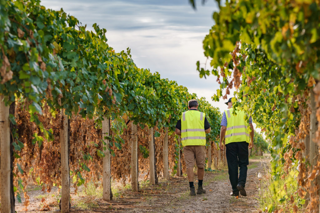
The Agriculture Land Local Area (Figure 60) encompasses extensive areas of dryland cropping and grazing; irrigation along the Murray River corridor from Nyah to the South Australian Border; and a groundwater irrigation district centred on the town of Murrayville. These productive landscapes also support significant natural, cultural and social values across the region.
The Priority bio-link corridors represent the most effective locations to enhance linkages between the region’s significant ecological landscapes (i.e. Local Assets), providing a framework to target delivery of revegetation works that are aiming to improve connectivity across fragmented landscapes.
The landscape encompasses eight sub-management units to support targeted planning and delivery processes within the larger landscape where required (see Figure 40). Three units recognise climatic/land system x threat process interactions within the dryland agricultural landscape (i.e. separated into northern, central and southern mallee); and five reflect the individual bio-link corridors identified as priority locations for improving for habitat connectivity.
As a dispersed landscape, the Agricultural Land area adjoins and interacts with each of the region’s eight discrete Local Areas.
Agriculture plays a major role in sustaining the economy of the region, with the gross value of production in 2019–20 being some $2.43 billion; $1.34 billion for irrigated crops, $933 million for dryland crops, and $149 million for livestock enterprises.
Clearing of Mallee vegetation for agricultural production across this landscape has resulted in a mosaic of scattered patches of remnant vegetation. The 107,074 hectares of native vegetation that does remain in small reserves, on private land, and along the roadsides and rail reserves dissecting the region does however provide significant habitat value. They are of particular importance for the threatened flora they contain and for the connectivity opportunities they provide to our region’s fauna.
Of this remaining vegetation, 55 percent is classified as Vulnerable; encompassing Woorinen Mallee (26%), Semi-arid Woodland (15%) and Chenopod Mallee (13%) EVCs. A further 21 percent is classified as Endangered, consisting primarily of Ridged Plains Mallee (10%), Parilla Mallee (6%) and Plains Savannah (3%) EVCs.
This vegetation represents a large proportion of the distribution of three EPBC listed ecological communities and the fauna they support: the Endangered Buloke Woodlands of the Riverina and Murray-Darling Depression Bioregions; the Critically Endangered Plains Mallee Box Woodlands of the Murray Darling Depression and Riverina Bioregions; and the Critically Endangered Natural Grasslands of the Murray Valley Plains.
The area also contains a number of dispersed wetlands. These are mostly saline systems (salinas and boinkas) in the centre and south-east of the region, associated with natural groundwater discharge sites. They are generally semi-permanent and characterised by salt tolerant flora.
In the south, there are numerous ephemeral wetlands that would have historically been inundated by local catchment run-off. With significant changes to the hydrology of the region through agricultural development (e.g. clearing and cultivation) they were dependant on water from a domestic channel system. And subsequently, following pipeline establishment they now rely on connections to receive water allocations.
This landscape is recognised as having high value to Traditional Owners, with numerous cultural sites recorded. The area has cultural importance to several Traditional Owner groups identifying connections to Country across the landscape.
Two Registered Aboriginal Parties, Barengi Gadjin Land Council and First People of the Millewa Mallee has statutory responsibilities for managing Aboriginal Cultural Heritage on Country across parts of the Local Area (see Figure 2).
Some 62 percent of the Mallee is private land, with individual landholders being primarily responsible for its management. There are currently 1,599 rural land holdings across both the dryland and irrigation industries. Agriculture is also the main industry sector covering approximately 19 percent of those employed in the region and is central to many of the Mallee’s small regional communities.
Industry groups such as Dried Fruits Australia, Citrus Australia Limited, Australian Table Grapes Association, Murray Valley Winegrowers, Almond Board Australia, Mallee Sustainable Farming, Birchip Cropping Group and the Victorian Farmers Federation are all active in the region. All the Landcare groups in the region also have an interest in NRM which encompasses both natural and productive landscapes.
Management actions that protect and enhance the significant values of this Local Area will provide for integrated, landscape-scale outcomes that also deliver against the whole-of-region medium-term (6-year) outcomes targets identified for our Biodiversity, Waterways, Agricultural Land, Culture and Heritage, and Community Capacity for NRM assets. Table 22 provides an overview of priority management actions and targets to be implemented within the area, and the local stakeholders that will contribute to their delivery (see Appendix 7 for complete list of Priority Management Directions).
A separate Agricultural Land Local Area Action Plan will provide further detail on stakeholder interests, existing programs/activities, and future investment priorities. The plan will be reviewed annually in consultation with stakeholders to ensure currency and inform ongoing investment/delivery priorities.