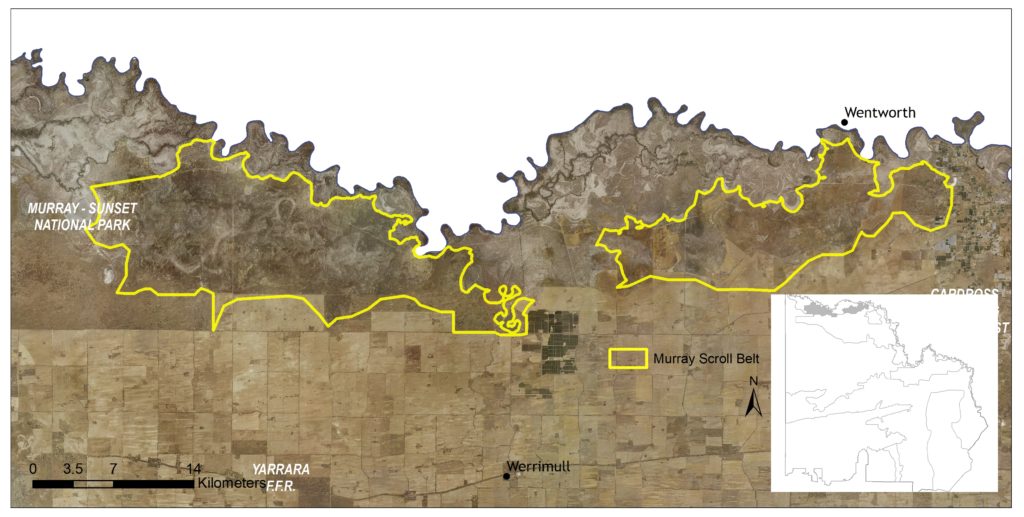
This 50,070 hectare landscape includes small portions of the Murray Sunset National Park (in the east, central and far west parts of the Local Area); and Neds Corner Station, a 30,000 hectare conservation reserve. The majority of the area is sparsely populated.
Approximately 25 percent of the landscape is public land and 60 percent is managed as a conservation reserve (65). Agriculture, mostly dryland, represents the other primary land use within the area (66). Three other Local Areas adjoin the Murray Scroll Belt: Murray Sunset Complex in the north west; the Murray River Floodplain directly to the north; and Agricultural Land to the south (Figure 46).
Prior to becoming a conservation reserve, the 30,000 hectare Neds Corner Station was a heavily grazed agricultural property. Since purchasing the property in 2002, Trust for Nature has undertaken extensive regeneration programs to support the return of native plants and animals. In May 2022 it was announced that Trust for Nature will be transferring ownership of the station to First People of the Millewa Mallee Aboriginal Corporation (FPMMAC). With the transfer scheduled to be completed within two years, this will represent the largest parcel of private land to be returned to traditional owners in Victoria.
(65) While most of Neds Corner Station is located in this Murray Scroll Belt Local area, a small area (3,558 ha) overlaps with the Murray Floodplain local area.
(66) See Local Area 9 for further detail on associated agricultural land values and priorities.
Around 85 percent (43,000 ha) of native vegetation has been retained in some form across the landscape, characterised by Chenopod Shrubland associated with saline soils of the Murray River’s flat alluvial terraces. Communities classified as ‘depleted’ accounts for 92 percent of the vegetation, including Low Chenopod Shrubland (65%) and Semi-arid Chenopod Woodland (26%). There are also small areas of the Vulnerable Chenopod Mallee (5%) and Semi-arid Woodland (2%) EVCs. State-wide modelling identifies 41,249 hectares (82% of total area) of habitat occurring within this area as being of the highest ecological value to Victoria (top 20%) and therefore a priority for protection and enhancement (see Appendix 8).
In total, 131 species listed as threatened at a federal and/or state level have been recorded as occurring within this Local Area, comprising of 32 birds, nine reptiles, four fish, one mammal, one amphibian and 84 plants. Habitat distribution models identifiy that the area is of particular importance to the conservation of Red naped Snake, Saltbush Striped Skink, Giles Planigale, and two plant species (Soda Bush and Slender Sunray); due to the proportion of their Victorian range (i.e. >50%) contained in this landscape.
Species identified as having local significance and/or cultural importance include Darling and Garland Lilies, Emu Bushes, Desert Groundsel, Slender Sunray, Purple Swainson-pea, Kneed Swainson-pea, Fat-tailed Dunnart, Giles Planigale, Hooded Scaly-foot, Samphire Skink, Mud Adder and Growling Grass Frog (67).
Neds Corner Station is home to almost 1,000 species, including 77 threatened plants, 24 reptiles and more than 120 types of birds.
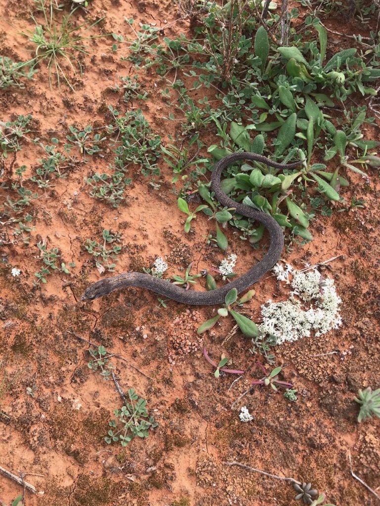
Significant fauna species that have been recorded at the conservation property include the threatened De Vis’ Banded Snake, Hooded Scaly-foot (Figure 47), Growling Grass Frog, Crimsen Chat, and numerous species of microbats. The Large Hard-head Daisy was also discovered at the property, a new species for Victoria.
(67) A complete list of species identified as a priority for management will be provided in the associated Murray Scroll Belt Local Area Action Plan.
This landscape is recognised as having high value to Traditional Owners, with a large number of cultural sites recorded across the Local Area.
First People of the Millewa Mallee Aboriginal Corporation has statutory responsibilities for managing Aboriginal Cultural Heritage on Country in this area.
Integrating Traditional Owner cultural values, practices, knowledge and objectives into the management of the landscape is considered a high priority to facilitate increased participation in local NRM and support the broader process of self-determination.
There are several community-based groups actively involved in NRM across the area, including; Landcare (Millewa Carwarp, Lindsay Point, Mallee Bushland Care), and BirdLife Mildura.
Neds Corner Station is frequently visited by nature lovers and educational groups (schools and universities) and is enabling research of the landscape through archaeological digs and engagement with Traditional Owners to further knowledge and conservation science.
The low height of the shrubland vegetation across much of the landscape makes it particularly susceptible to off-road driving. New tracks establish readily and are slow to rehabilitate.
Management actions that protect and enhance the significant values of this Local Area will provide for integrated, landscape-scale outcomes that also deliver against the whole-of-region medium-term (6-year) outcomes targets identified for our Biodiversity, Waterways, Agricultural Land, Culture and Heritage, and Community Capacity for NRM assets. Table 16 provides an overview of priority management actions and targets to be implemented within the area, and the local stakeholders that will contribute to their delivery (see Appendix 7 for complete list of Priority Management Directions).
A separate Murray Scroll Belt Local Area Action Plan will provide further detail on stakeholder interests, existing programs/activities, and future investment priorities. The plan will be reviewed annually in consultation with stakeholders to ensure currency and inform ongoing investment/delivery priorities.