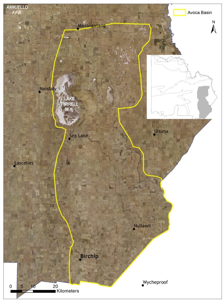
This 430,397 hectare landscape stretches from the southern boundary of the Mallee region extending into the Avoca Basin Terminal Lakes System and Creeklines. It includes the regional townships of Sea Lake and Birchip.
Approximately eight percent of the landscape is public land, with dryland cropping being the primary land use (72). Agricultural Land is the only other Local Areas adjoining this landscape, with North Central CMA to the south (Figure 54).
(72) See Local Area 9 for further detail on associated agricultural land values and priorities.
Around 15 percent (65,000 ha) of native vegetation has been retained across the landscape, with some 27 percent classified as Vulnerable; consisting primarily of Woorinen Mallee (10%), Semi-arid Woodland (7%), Lignum Swampy Woodland (4%) and Semi-arid Chenopod Woodland (3%). A further 26 percent of the vegetation is classified as Endangered, consisting primarily of Ridged Plains Mallee (17%) and Plains Savannah (7%).
This includes three EPBC listed ecological communities, the Endangered Buloke Woodlands of the Riverina and Murray-Darling Depression Bioregions; and the Critically Endangered Plains Mallee Box Woodlands of the Murray Darling Depression and Riverina Bioregions and the Natural Grasslands of the Murray Valley Plains.
Agricultural development across the area has meant that these communities are now primarily fragmented remnants distributed along roadsides, small public reserves and numerous patches on private land.
State-wide modelling identifies 46,000 hectares (11% of total area) of habitat occurring within this area as being of the highest ecological value to Victoria (top 20%) and therefore a priority for protection and enhancement (see Appendix 8).
Some 26,227 hectares of waterways occur across the area, with six wetlands (17,502 ha) and three reaches (514 ha) identified as a priority for management.
Direl (Lake Tyrrell) is Victoria’s largest salt lake and the largest saline groundwater discharge lake in the Murray- Darling Basin. It is listed in the National Directory of Important Wetlands for its geomorphological significance as an ancient salina system dating back some 120,000 years. A number of bird species named in migratory bird agreements (JAMBA, CAMBA and ROKAMBA) have also been observed on the Lake.
The Tyrrell and Lalbert Creeks are north flowing ephemeral distributaries of the Avoca River. Tyrrell Creek terminates in Direl (Lake Tyrrell) while Lalbert Creek terminates in Lake Timboram. Both the channel and the floodplain systems of Tyrrell and Lalbert Creeks are listed in the Directory of Important Wetlands as part of the Bulunguluke Wetlands and Lake Lalbert systems that lie outside Mallee regional boundary.
A sequence of small wetlands and wetland complexes also stretch in a discontinuous band northward from Birchip to Sea Lake, the largest of which include Lake Tchum North and South, Lake Marlbed and Green Lake.
In total, 89 species listed as threatened at a federal and/ or state level have been recorded as occurring within this Local Area since 1990; comprising 21 birds, two reptiles, and 66 plants. Habitat distribution models identify that the area is of particular importance to the conservation of the Beaked Gecko, the Lined Earless Dragon, Samphire Skink, and several threatened plant species (e.g. Angler Saltbush, Quambatook Mallee, Orange Darling-pea) due to the proportion of their Victorian range (i.e. >10%) contained in this landscape.

Species identified as having local significance and/or cultural importance include: Chariot Wheels, Buloke Woodlands, Needlewood Hakeas, Camel Bush, Plains- wanderer, Brown Tree Creeper, Bush-stone Curlew, Carpet Python (Figure 55), and Growling Grass Frog (73).
(73) A complete list of species identified as a priority for management will be provided in the associated Murray River Floodplain Local Area Action Plan.
This landscape is recognised as having high value to Traditional Owners, with a large number of cultural sites recorded. The area holds cultural importance to several Traditional Owner groups identifying connections to Country across the landscape.
There is one Registered Aboriginal Party, Barengi Gadjin Land Council Aboriginal Corporation, that has statutory responsibilities for managing Aboriginal Cultural Heritage on Country in this landscape; specifically, the eastern fringe of the Local Area.
Integrating Traditional Owner cultural values, practices, knowledge and objectives into the management of the landscape is considered a high priority to facilitate increased participation in local NRM and support the broader process of self-determination.
The lakes and larger reserves within this area are popular for day use recreation, with activities including community recreation opportunity and aesthetic beauty. Direl (Lake Tyrrell) is also a popular tourism destination for national and international visitors. Off track impacts and rubbish dumping are an ongoing concern for natural and cultural values management within more sensitive areas of this Local Area.
Community interest in conservation in this area is high, with active groups including Landcare (Manangatang, Kooloonong-Natya, Nyah-West, Sea Lake, Waitchie, Berriwillock, Birchip, Culgoa, Lalbert, Nullawil, Ultima and Woomelang/Lascelles groups), Mid-Murray Field Naturalists, Birchip & District Fishing Club, Tchum Lake South Committee of Management, and Advance Sea Lake Inc.
Management actions that protect and enhance the significant values of this Local Area will provide for integrated, landscape-scale outcomes that also deliver against the whole-of-region medium-term (6-year) outcomes targets identified for our Biodiversity, Waterways, Agricultural Land, Culture and Heritage, and Community Capacity for NRM assets. Table 19 provides an overview of priority management actions and targets to be implemented within the area, and the local stakeholders that will contribute to their delivery (see Appendix 7 for complete list of Priority Management Directions).
A separate Avoca Basin Action Plan will provide further detail on stakeholder interests, existing programs/ activities, and future investment priorities. The plan will be reviewed annually in consultation with stakeholders to ensure currency and inform ongoing investment/delivery priorities.