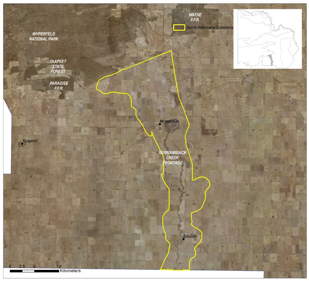
This 35,108 hectare landscape encompasses Yarriambiack Creek, Coorong and Lascelles Lakes, and small woodland and grassland remnants. It includes the regional townships of Hopetoun and Beulah.
Approximately six percent of the landscape is public land, with dryland cropping being the primary land use (75). Two other Local Areas adjoin the North Wimmera Creeklines: Wyperfeld Complex in the north; and Agricultural Land along most of the remaining boundary (Figure 58). It also borders the Wimmera region to the south.
(75) See Local Area 9 for further detail on associated agricultural land values and priorities.
Around 11 percent (3,805 ha) of native vegetation has been retained in some form across the landscape. Overall, some 22 percent of the vegetation occurring with the area is classified as Vulnerable, consisting primarily of Lignum Swampy Woodland (19%) and Woorinen Mallee (2%) EVCs. A further 23 percent is classified as Endangered, encompassing Ridged Plains Mallee (8%), Plains Savannah (7%), Parilla Mallee (4%) and Plains Woodland EVCs.
This includes three EPBC listed ecological communities, the Endangered Buloke Woodlands of the Riverina and Murray-Darling Depression Bioregions; and the Critically Endangered Plains Mallee Box Woodlands of the Murray Darling Depression and Riverina Bioregions and Natural Grasslands of the Murray Valley Plains.
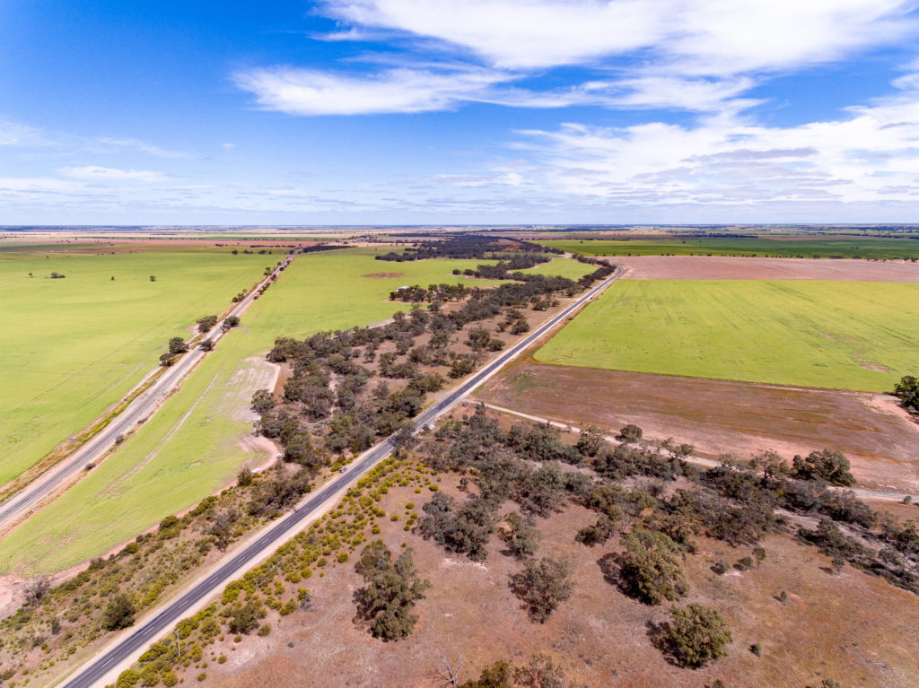
Agricultural development across the area has meant that these communities are now primarily fragmented remnants distributed along roadsides, small public reserves and isolated patches on private land.
State-wide modelling identifies 1,752 hectares (5% of total area) of habitat occurring within this area as being of the highest ecological value to Victoria (top 20%) and therefore a priority for protection and enhancement (see Appendix 8).
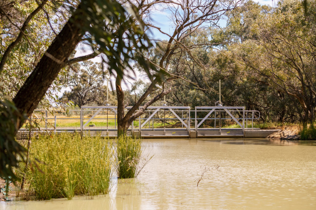
Some 1,056 hectares of waterways occur within the area, with one reach (170 ha) and three wetlands (737 ha) identified as a priority for management. This encompasses a relatively small (43 km) section of Yarriambiack Creek, a north flowing intermittent stream of the Wimmera River that terminates in Lake Coorong and Lake Lascelles, east of Hopetoun. Apart from small amounts of local run-off, flows in the creek are dependant on run-off upstream in the Wimmera River catchment and water supplied through the Wimmera Mallee Pipeline.
In total, 17 species listed as threatened at a federal and/or state level have been recorded as occurring within this Local Area since 1990; comprising nine birds, one amphibian and seven plants. Habitat distribution models identify that the area is of particular importance to the conservation of Blue-billed Duck, Ruddy Turnstone, Red Knot, Regent Parrot and Eastern Great Egret.
Yarriambiack Creek is recognised as having a long history of occupation and use by Aboriginal people, with a number of cultural sites heritage sites identified across the landscape. Barengi Gadjin Land Council has statutory responsibilities for managing Aboriginal Cultural Heritage on Country in this area.
This creek system is not only a source of water for these communities, it’s also a significant recreational resource and aesthetic feature with the Yarriambiack Creek frontage and the Lakes Reserve making up the only significant areas of public land in this area (Figure 59). Due to the close proximity of waterways they are popular for day use recreation, and camping.
Active groups include the Beulah and Hopetoun Landcare Groups, Friends of Yarriambiack Creek, Lake Lascelles/Coorong Committee of Management, and Murray Darling Association.
Management actions that protect and enhance the significant values of this Local Area will provide for integrated, landscape-scale outcomes that also deliver against the whole-of-region medium-term (6-year) outcomes targets identified for our Biodiversity, Waterway, Agricultural Land, Culture and Heritage, and Community Capacity for NRM assets. Table 21 provides an overview of priority management actions and targets to be implemented within the area, and the local stakeholders that will contribute to their delivery (see Appendix 7 for complete list of Priority Management Directions).
A separate North Wimmera Creeklines Local Area Action Plan will provide further detail on stakeholder interests, existing programs/activities, and future investment priorities. The plan will be reviewed annually in consultation with stakeholders to ensure currency and inform ongoing investment/delivery priorities.