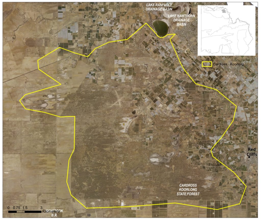
This 21,506 hectare landscape includes the Cardross and Koorlong Lakes, Wargan Basins, Koorlong State Forest and several smaller reserves. It is one of the more heavily populated areas in the region, encompassing the Cabarita, Cardross and Koorlong communities; and parts of Merbein South, Mildura, Irymple and Red Cliffs.
Approximately 47 percent the landscape is public land, with agriculture (mainly irrigated) (63) and built up residential areas representing the other primary land uses within the area (Figure 43). Two other Local Areas adjoin the Cardross-Koorlong Local Area: the Murray River Floodplain to the north; and Agricultural Land along most of the remaining boundary.
(63) See Local Area 9 for further detail on associated agricultural land values and priorities
Around 11,000 hectares (50%) of native vegetation has been retained in some form across the landscape. Of this, 94 percent is classified as Vulnerable; consisting primarily of Chenopod Mallee (51%) and Semi-arid Woodland (37%) EVCs.
State-wide modelling identifies 9,600 hectares (45% of total area) of habitat occurring within this area as being of the highest ecological value to Victoria (top 20%) and therefore a priority for protection and enhancement (see Appendix 8).
Some 985 hectares of wetlands occur within the area, of which three sites (Cardross Lakes, Koorlong Lakes and Wargan Basins) are considered a priority for management.
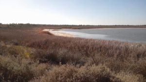
These sites are a series of natural depressions that were altered in the 1930’s to facilitate their use as irrigation drainage basins. A consistent supply of water has subsequently transformed the systems into semi-permanent lakes, with both Wargan Basins and Cardross Lakes listed on the national Directory of Important Wetlands due to the habitat they provide for waterbirds (including species listed under international migratory bird agreements) and native fish.
Improved irrigation practices in the last twenty years have however significantly reduced the amount of drainage water entering the Lakes, reducing water levels but increasing salinity levels in these artificial wetlands. As a result, the Lakes now support fewer native fish species but are still one of the last remaining refuges for the Murray hardyhead (Figure 44), a federally listed (Endangered) species which is able to survive and reproduce in saline wetlands.

In total, 57 species listed as threatened at a federal and/ or state level have been recorded as occurring within this Local Area since 1990; comprising of 28 birds, two reptiles, two fish and 25 plants. Habitat distribution models identify that in addition to the Murray hardyhead, the area is of particular importance to the conservation of two threatened plant species (Limestone Sida and Dwarf Lantern Flower) due to the proportion of their Victorian range (i.e. >10%) contained in this landscape.
Semi-arid Woodland vegetation communities and the fauna they support are also considered to have high local significance (64). This encompasses the EPBC listed (Endangered) Buloke Woodlands of the Riverina and Murray-Darling Depression Bioregions ecological community.
(64) A complete list of species identified as a priority for management will be provided in the associated Cardross-Koorlong Local Area Action Plan.
This landscape is recognised as having high value to Traditional Owners, with a large number of cultural sites recorded across the Local Area. First People of the Millewa Mallee Aboriginal Corporation has statutory responsibilities for managing Aboriginal Cultural Heritage on Country in this area.
Integrating Traditional Owner cultural values, practices, knowledge and objectives into the management of the landscape is considered a high priority to facilitate increased participation in local NRM and support the broader process of self-determination.
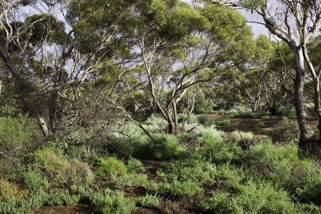
Both the lakes and larger reserves within this area are popular for day use recreation, with activities including fishing, walking, and bird watching. Koorlong State Forest (Figure 45) in particular, is used by a range of recreational vehicles, with off track impacts and rubbish dumping a concern for natural and cultural values management.
Community interest in conservation in this area is high, with volunteerism and participation in education- based activities facilitated by proximity to the region’s larger population centres. Active groups include Cabarita Inc., Millewa-Carwarp Landcare Group, Yelta Landcare Group, Murray Darling Association, Sunraysia Bushwalkers Inc., BirdLife Mildura, Murray Lower Darling Rivers Indigenous Nations, and Sunraysia OzFish Unlimited.
Management actions that protect and enhance the significant values of this Local Area will provide for integrated, landscape-scale outcomes that also deliver against the whole-of-region medium-term (6-year) outcomes targets identified for our Biodiversity, Waterways, Agricultural Land, Culture and Heritage, and Community Capacity for NRM assets. Table 15 provides an overview of priority management actions and targets to be implemented within the area, and the local stakeholders that will contribute to their delivery (see Appendix 7 for complete list of Priority Management Directions).
A separate Cardross-Koorlong Local Area Action Plan will provide further detail on stakeholder interests, existing programs/activities, and future investment priorities. The plan will be reviewed annually in consultation with stakeholders to ensure currency and inform ongoing investment/delivery priorities.