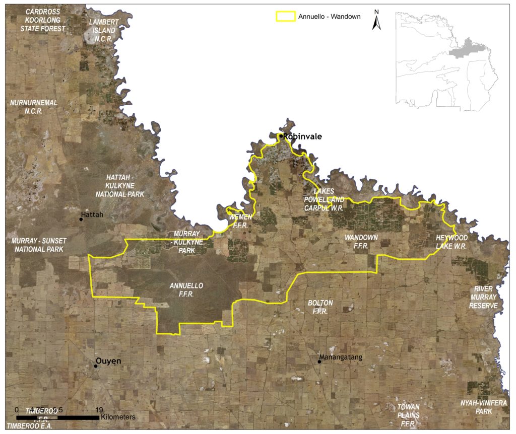
This 152,858 hectare landscape includes Annuello, Wandown and Menzies Flora and Fauna Reserves, providing an important biolink between Murray-Sunset National Park and Hattah-Kulkyne National Park.
Approximately 31 percent of the landscape is public land, with significant areas of agriculture (dryland and irrigation) occurring across the area (70). Two other Local Areas adjoin Annuello-Wandown: Murray Sunset Complex at Hattah; the Murray River Floodplain along the northern boundary; and Agricultural Land to the south (Figure 51).
(70) See Local Area 9 for further detail on associated agricultural land values and priorities.
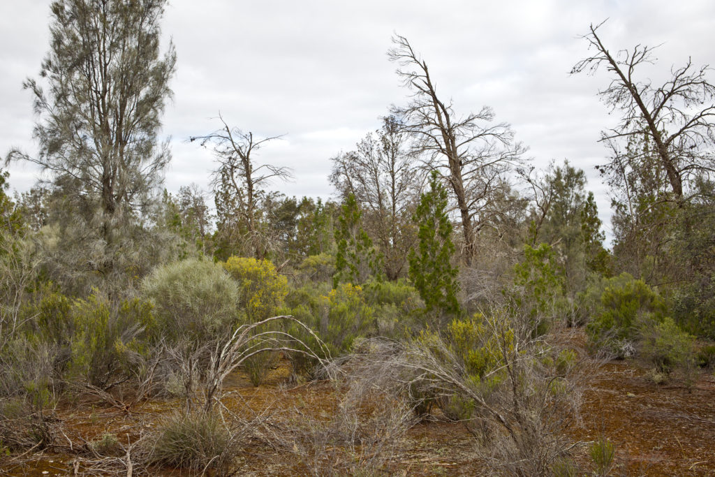
Around 38 percent (58,983 ha) of native vegetation has been retained in some form across the landscape, with the Annuello Flora and Fauna Reserve encompassing nearly 43,000 hectares. Overall, 13 percent of the vegetation occurring with the area is classified as Vulnerable, consisting primarily of Chenopod Mallee (5%), Semi-arid Woodland (3%) and Semi-arid Parilla Woodland (3%) EVCs.
This includes small areas of the EPBC listed (Endangered) Buloke Woodlands of the Riverina and Murray-Darling Depression Bioregions ecological community.
State-wide modelling identifies 9,350 hectares (6% of total area) of habitat occurring within this area as being of the highest ecological value to Victoria (top 20%) and therefore a priority for protection and enhancement (see Appendix 8).
In total, 41 species listed as threatened at a federal and/ or state level have been recorded as occurring within this Local Area since 1990; comprising 15 birds, one reptile, and 25 plants. Habitat distribution models identify that the area is important to the conservation of several species included in the EPBC listed (Endangered) Mallee Bird Community (i.e. Mallee Emu-wren, Black-eared Miner, Red-lored Whistler, and Striated Grasswren).
Species identified as having local significance and/or cultural importance include, South-eastern Long-eared Bat, Mallee Ningui, Desert Skink, Mallee Worm Lizard, and the Threatened Mallee Bird Community (71).
(71) A complete list of species identified as a priority for management will be provided in the associated Murray River Floodplain Local Area Action Plan.
This landscape is recognised as having high value to Traditional Owners, with a large number of cultural sites recorded. The area holds cultural importance to several Traditional Owner groups identifying connections to Country across the landscape.
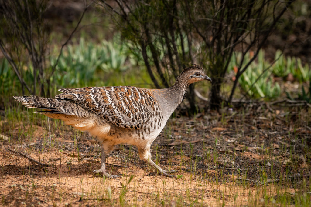
This area is favoured for bushwalking, wildflowers and photography. This area includes some significant roadside vegetation and is an important survey site for the Victorian Malleefowl Recovery Group and has been identified by BirdLife International for its importance as a bird area for both the Malleefowl (Figure 52) and Regent Parrot. Recreational pressure is relatively low but includes littering, track proliferation, firewood collection, soil compaction and site erosion. The nature of the impacts is typically localised around a particular site and is highly dependent on the accessibility, popularity and sensitivity of the site along with the level of management the location receives.
Community interest in conservation in this area is high, with volunteerism and participation in education based activities facilitated by proximity to the region’s larger population centres. Active groups include Landcare (Robinvale and Annuello, Manangatang, Kooloonong-Natya, and Mallee), BirdLife Mildura, Mid-Murray Field Naturalists, Victorian Malleefowl Recovery Group (VMRG), Sunraysia Bushwalkers Inc. and the Mildura 4WD Club.
Management actions that protect and enhance the significant values of this Local Area will provide for integrated, landscape-scale outcomes that also deliver against the whole-of-region medium-term (6-year) outcomes targets identified for our Biodiversity, Waterways, Agricultural Land, Culture and Heritage, and Community Capacity for NRM assets. Table 18 provides an overview of priority management actions and targets to be implemented within the area, and the local stakeholders that will contribute to their delivery (see Appendix 7 for complete list of Priority Management Directions).
A separate Annuello-Wandown Local Area Action Plan will provide further detail on stakeholder interests, existing programs/activities, and future investment priorities.
The plan will be reviewed annually in consultation with stakeholders to ensure currency and inform ongoing investment/delivery priorities.